Newark Public Safety Director Anthony F. Ambrose reports that due to tomorrow’s anticipated heavy rainfall and potential thunderstorms, many streets may be flooded and should be avoided.
Rain showers are expected to begin before 2 p.m. with wind gusts of up to 32 mph. Potential thunderstorms are predicted on Thursday night, with continued gusty winds and expected rainfall of between 1 and 2 inches.
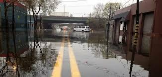
The following locations should be avoided due to flooding conditions or the potential for flooding:
Clay Street and McCarter Highway
South Street and Van Buren Street
Jefferson and Chestnut Streets
State Street near Broad Street
Jabez and Backus Streets
357 Wilson Avenue
Manufacturers Place and Hyatt Street
Magazine Street and Avenue L
Avenue L and Wilson Avenue
Ferry and Foundry Streets
Norfolk Street
Orange Street
Nesbitt Street
McClellan and Frelinghuysen Avenue, and
Frelinghuysen Avenue and the Route 22 underpass.
The Department of Public Safety is coordinating responses to burglar alarms, flooding conditions and other weather-related incidents through the combined use of Police, Fire and Office of Emergency Management Personnel.
Special attention should be given to unsecured outdoor furniture, awnings, refuse and building materials.
For fire safety, please utilize flashlights, instead of candles, should you lose electricity due to this weather event.
Director Ambrose urges anyone with information about any criminal or suspicious activity to call the Department's 24-hour Crime Stopper tip line at 1-877-NWK-TIPS (1-877-695-8477).
All anonymous Crime Stopper tips are kept confidential and could result in a reward.
IMAGE: File