
By: Richard L. Smith
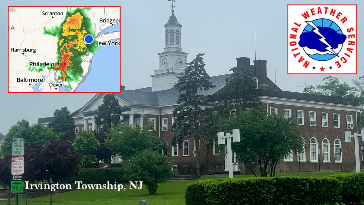
A large, fast-moving storm system is currently sweeping through New Jersey, bringing intense rainfall and thunderstorms to Essex County, with Irvington experiencing especially heavy downpours Friday afternoon.
According to radar data from 12:14 p.m., the storm—which began its track across southeastern Pennsylvania—has moved into northern and central New Jersey, affecting towns such as Newark, East Orange, Elizabeth, and Bloomfield. Lightning and periods of torrential rain are also being reported in Union, Maplewood, and the surrounding areas.

Meteorologists at the National Weather Service say the storm system will continue pushing northeast through the early afternoon, with the potential for localized flooding in low-lying areas.
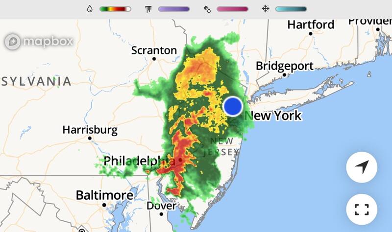
“Thunderstorms with heavy rainfall are expected to impact much of northern New Jersey today,” the NWS said in a midday update.
“Residents should remain alert for brief flooding in poor drainage areas and allow extra travel time.”

The heaviest rain bands are expected to move out of Essex County by late afternoon.
However, scattered showers and isolated storms may linger through the evening.